Cadillac Mountain Map
Find Your Way Around Cadillac Mountain in Acadia National Park
A good Cadillac Mountain map is your best companion for exploring one of Acadia National Park’s most iconic peaks. Rising 1,530 feet above the Atlantic, Cadillac dominates Mount Desert Island and rewards every visitor with sweeping views of Bar Harbor, Frenchman Bay, and the Porcupine Islands. Whether you plan to drive, hike, or simply take in the sunrise, a clear map helps you make the most of every moment on the mountain.
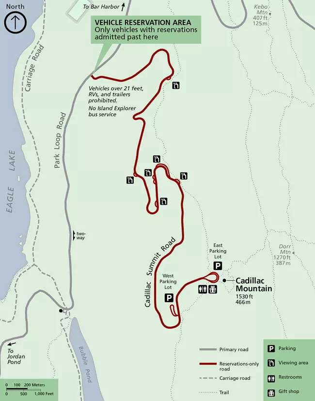
The official map of Cadillac Mountain outlines everything you need to know before setting out — from the 3.5-mile Summit Road and parking zones to the short paved summit loop, restrooms, and gift shop. It also highlights the trailheads for the North Ridge and South Ridge Trails, so you can plan your route according to time, weather, and fitness level. Visitors arriving for sunrise will find the reservation checkpoint clearly marked, ensuring they know exactly where to go when their entry window opens.
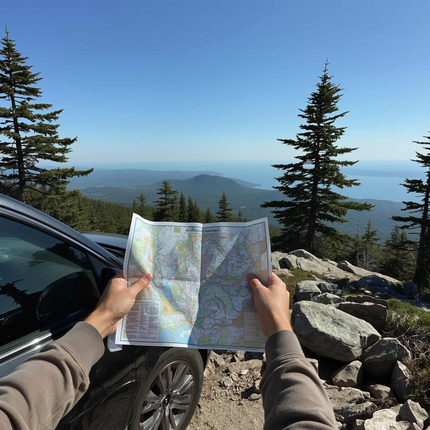
Because cell service can be patchy on the mountain, it’s smart to download or print a Cadillac Mountain map PDF before heading out. Having that offline reference makes it easy to locate turnouts, overlooks, and trail connectors without relying on reception. Whether you’re chasing that first light of day or savoring a late-afternoon panorama, a good map turns every visit into a confident, well-planned adventure.
Click here to download your free printable map
Perfect for planning your route before cell service drops on the summit.
• The official Cadillac Mountain map in Acadia National Park shows how the Summit Road, trails, parking, and facilities all connect across Mount Desert Island.
• The detailed map of Cadillac Mountain identifies North Ridge and South Ridge trailheads, picnic areas, restrooms, and pullouts with sweeping views over Bar Harbor and Frenchman Bay.
• Visitors can use the acadia national park cadillac mountain map to locate the reservation checkpoint for sunrise entry and find turnouts for photos along the 3.5-mile drive.
• The cadillac mountain maine map links the summit to the wider island network, showing how scenic roads connect with coastal drives, carriage roads, and nearby visitor centers.
• Whether downloaded as a PDF or picked up in print, the map of Cadillac Mountain Maine gives every traveler a clear, confident route to explore this iconic peak from base to summit.
Understanding the Cadillac Mountain Map
A good map is more than a tool — it’s a key to exploring Cadillac Mountain with confidence. Whether you’re driving, hiking, or simply planning your visit, the Cadillac Mountain map helps you visualize how everything connects across the summit area. From the winding 3.5-mile Summit Road to the short paved loop trail at the top, the Acadia National Park Cadillac Mountain map outlines every important feature that first-time visitors should know before setting out.
The map clearly marks the Summit Road, which begins off the Park Loop Road and climbs steadily through spruce forest and granite ridges. As it winds upward, you’ll see the road’s pullouts, scenic overlooks, and the two primary parking areas — East and West — highlighted for easy reference. The Cadillac Mountain Maine map also pinpoints essential amenities like restrooms, the small summit gift shop, and the paved Summit Loop Trail, a half-mile path that circles the top with panoramic views over Bar Harbor, Frenchman Bay, and the Porcupine Islands.
One of the most helpful features shown on the map of Cadillac Mountain Maine is the reservation checkpoint. Since timed vehicle entries were introduced, this marked location ensures you know exactly where rangers will confirm your pass before allowing access to the summit. For those planning a sunrise or sunset visit, this small detail saves time and prevents frustration on busy mornings.
The map’s labeled trailheads show how the Cadillac North Ridge Trail and South Ridge Trail meet the road, helping hikers understand how to link their route with a scenic drive back down. It also outlines connectors like Canon Brook and Jesup Path — ideal for building custom loops or finding shaded routes during warmer months.
Because phone signal can fade near the top, visitors often download a Cadillac Mountain map PDF or grab a printed copy from an Acadia visitor center before their trip. Having an offline version means you can easily spot facilities, trail intersections, and parking zones even without service.
Before setting out, spend a few minutes studying the Cadillac Mountain map. Knowing where everything lies — from restrooms to ridge trails — transforms a good visit into a smooth, stress-free adventure on the crown jewel of Acadia National Park.
• The Cadillac Mountain map pinpoints the vehicle reservation checkpoint — crucial for sunrise and peak-season access.
• The Acadia National Park Cadillac Mountain map marks both East and West parking areas, scenic overlooks, and restrooms near the summit.
• Downloading a Cadillac Mountain map PDF before your visit ensures you can navigate even when cell service drops near the top.
• On the map of Cadillac Mountain Maine, key hiking routes such as North Ridge and South Ridge Trails are clearly labeled for safe planning.
• A printed Cadillac Mountain Maine map from the visitor center highlights picnic areas, trail connections, and the paved Summit Loop Trail that circles the peak.
Understanding the Summit Road Map
The Cadillac Summit Road is the backbone of every visit to the mountain, and understanding its layout through the Cadillac Mountain map makes all the difference. Stretching 3.5 miles from the Park Loop Road to the summit, this scenic drive winds through forested slopes, exposed granite ridges, and some of the most breathtaking vantage points in Acadia National Park. The map gives you a complete picture of how the Summit Road connects with nearby trailheads, rest areas, and the East and West parking lots at the top, helping you plan your route with ease.
If you look closely at the Acadia National Park Cadillac Mountain map, you’ll notice the road’s gentle switchbacks designed to handle the mountain’s elevation gain. Along the way, several pullouts are clearly marked — perfect for taking photos or letting faster vehicles pass. The Cadillac Mountain Maine map also pinpoints where the reservation checkpoint is located, a crucial feature for those visiting during the timed-entry period. Knowing exactly where that checkpoint sits helps you arrive within your reservation window and avoid the frustration of being turned back at the gate.

Once you reach the summit area, the map shows the East Parking Lot closest to sunrise overlooks and the West Parking Lot, which offers better sunset views. Between them, the Summit Loop Trail creates an easy half-mile paved circle around the top, clearly marked on the map of Cadillac Mountain Maine. This loop provides wheelchair access and benches for resting, making it suitable for almost every visitor. The map also highlights the small restrooms, the summit gift shop, and interpretive panels that explain the park’s geology and history.
Drivers can use the Cadillac Mountain map to spot hidden gems along the drive, such as small pullouts where fog rolls through the valleys or where autumn colors ignite the forest below. These aren’t always signposted on the road, but they’re easy to find when you’ve studied the map ahead of time. It’s also worth noting how the Summit Road ties back into the Park Loop Road — the map shows the exit routes that lead either toward Jordan Pond or back to Bar Harbor, depending on your plans for the rest of the day.
Whether you’re heading up for sunrise, navigating midday crowds, or coasting down at dusk, the Cadillac Mountain map helps you move confidently along one of the most famous scenic drives in New England. It’s more than a piece of paper — it’s your guide to making every turn, overlook, and stop count.
• The Cadillac Mountain map highlights the 3.5-mile Summit Road linking Park Loop Road to the mountain’s East and West parking areas.
• On the Acadia National Park Cadillac Mountain map, the vehicle reservation checkpoint is marked before the upper switchbacks — essential for timed entry during peak months.
• The map of Cadillac Mountain shows accessible restrooms, picnic areas, and the paved Summit Loop Trail at the top.
• Drivers can use the Cadillac Mountain Maine map to locate scenic pullouts and photo stops that are easy to miss when relying on GPS alone.
• Downloading or printing the map of Cadillac Mountain Maine ensures you can navigate safely even if mobile coverage drops near the summit.
How to Read the Cadillac Mountain Map
Learning how to read the Cadillac Mountain map isn’t just about finding your way — it’s about understanding how every element of Acadia’s most famous peak fits together. The map gives you a bird’s-eye view of the mountain, showing how the Summit Road, hiking trails, and viewing areas overlap across Mount Desert Island. Once you know what each symbol means, planning your visit becomes simple and stress-free.
The Acadia National Park Cadillac Mountain map uses clear color coding and symbols to separate features. Solid black lines mark paved roads like the Summit Road and Park Loop Road, while dotted lines represent hiking trails such as the North Ridge and South Ridge routes. Blue icons point to water-related features or picnic areas, and small brown squares indicate restrooms, trailheads, and parking zones. Together, these visual cues help you navigate efficiently, whether you’re driving, hiking, or photographing the views.
If you’re looking for panoramic overlooks, the map of Cadillac Mountain shows small triangular markers along both the road and the Summit Loop Trail. These mark designated viewpoints where you can pull over safely or pause on foot to take in the scenery. Many of the overlooks face east toward Bar Harbor and Frenchman Bay, while others face west, capturing sunsets over Blue Hill Bay. Being able to identify these markers in advance helps you choose the best stop for sunrise, sunset, or photography.
The Cadillac Mountain Maine map also highlights the trail network that ties into the summit. You’ll see how the North Ridge Trail parallels the Summit Road before meeting it near the top, and how the South Ridge Trail connects all the way to Blackwoods Campground. The map even outlines smaller connectors like Canon Brook and Jesup Path, which hikers can use to create looped routes. Reading the elevation lines helps you gauge difficulty — closer lines indicate steeper terrain, while wider spacing shows gradual inclines.
For safety and convenience, visitors are encouraged to carry either a printed copy or download a map of Cadillac Mountain Maine PDF from the National Park Service website. These maps include legend keys that explain every symbol and color, plus north arrows and scale bars that help you judge distance. When you’re on the mountain, a quick glance at the map can tell you whether you’re near the next overlook, trail junction, or parking lot.
In short, understanding the symbols, elevation lines, and routes on the Cadillac Mountain map turns an ordinary visit into an expert one — where every stop, photo, and turn feels intentional.
• The Cadillac Mountain map uses clear symbols for roads, trails, overlooks, and rest areas — study them before setting out.
• On the Acadia National Park Cadillac Mountain map, black lines indicate roads, dotted lines show hiking trails, and brown squares mark facilities like restrooms and parking.
• The map of Cadillac Mountain includes triangle markers for scenic overlooks where sunrise and sunset views are best.
• The Cadillac Mountain Maine map shows how North Ridge and South Ridge Trails link with the Summit Road and visitor facilities.
• Downloading a map of Cadillac Mountain Maine PDF ensures you always have a reliable reference, even when mobile coverage drops near the summit.
Using Your Map to Plan Your Visit
A Cadillac Mountain map isn’t just for orientation — it’s the key to planning a smoother, more enjoyable visit. With sunrise reservations, seasonal road closures, and dozens of scenic pullouts, the map gives you a clear picture of how to manage your time and expectations before you even arrive. Whether you’re heading up by car or exploring on foot, understanding how to use the map ensures that every moment on the mountain feels relaxed and intentional.
When planning your route, start with the Acadia National Park Cadillac Mountain map to identify entry points along the Park Loop Road. From there, trace the 3.5-mile Summit Road to the top, noting key pullouts and parking areas. The East Parking Lot is ideal for sunrise viewing, while the West Lot offers better light for sunset photos. By following these markers, you can decide whether to time your visit for early morning calm or the soft glow of evening. The map also shows nearby connector roads leading toward Jordan Pond, Sand Beach, and Bar Harbor — making it easy to combine Cadillac Mountain with other stops in Acadia.
For hikers, the map of Cadillac Mountain helps link trailheads and gauge elevation changes. You can see where the North Ridge and South Ridge Trails meet the Summit Road, helping you plan round-trip routes that finish near your parked car. The map also highlights shaded areas and exposed ledges, giving clues about when to hike certain trails based on weather or temperature. A quick look at contour lines helps you visualize how steep the climb will be and how long it might take to reach the summit.
The Cadillac Mountain Maine map is also invaluable for tracking services and accessibility. Restrooms, picnic tables, and the paved Summit Loop Trail are all clearly marked, allowing families, seniors, and mobility-assist users to plan accordingly. If you’re visiting during peak season, the map even shows alternate routes and turnouts that help avoid congestion near the summit checkpoint. Knowing these details ahead of time helps you stay flexible — especially when the mountain’s parking lots fill quickly.
Before you go, download a map of Cadillac Mountain Maine PDF from the National Park Service website or pick up a printed version at the visitor center. Offline maps are essential in Acadia, where cell reception can fade quickly. Studying your map the night before your visit lets you visualize the drive, pinpoint the best overlooks, and start your day with confidence.
In short, your map isn’t just a guide — it’s your trip planner, safety net, and insider’s pass to everything Cadillac Mountain has to offer.
• The Cadillac Mountain map helps you plan sunrise or sunset visits by marking the best viewing areas on the East and West sides of the summit.
• Use the Acadia National Park Cadillac Mountain map to locate trailheads, restrooms, and parking zones before arriving.
• The map of Cadillac Mountain outlines connector roads that link the summit with Bar Harbor, Jordan Pond, and Sand Beach for day-trip planning.
• The Cadillac Mountain Maine map highlights shaded trails and open ledges, helping hikers choose the best time of day to start their climb.
• A downloaded map of Cadillac Mountain Maine PDF keeps you on track even when cell reception drops near the top of the mountain.
Where to Get the Best Cadillac Mountain Map
Finding the right Cadillac Mountain map before your visit can make a world of difference. Not all maps are created equal — some focus on trails, others on driving routes, and a few offer both with detailed topography and elevation. The best map depends on how you plan to explore Acadia National Park: by car, on foot, or a mix of both. Knowing where to find an accurate, up-to-date version ensures your experience on the mountain is effortless and rewarding.
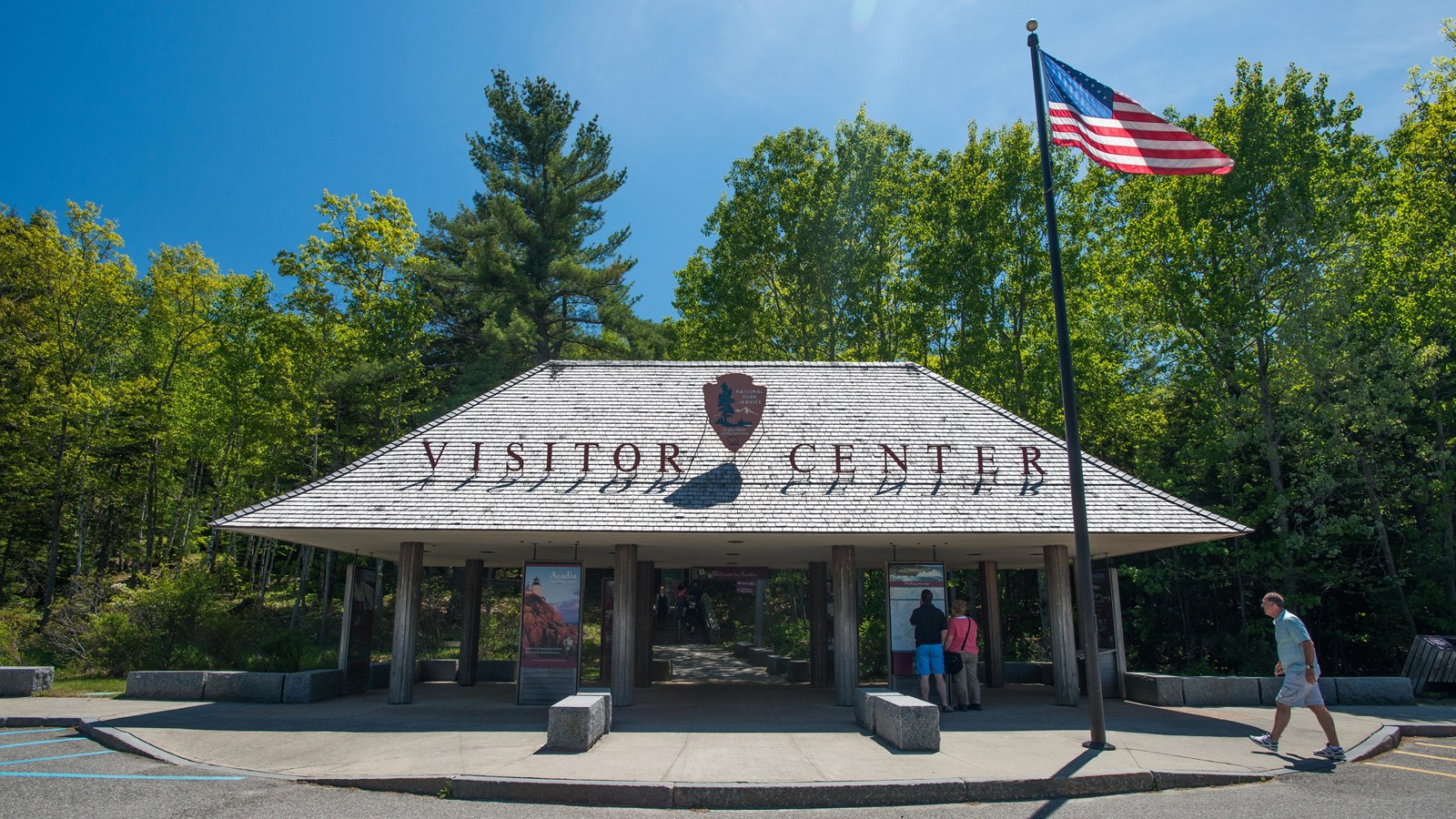
The most reliable option is always the Acadia National Park Cadillac Mountain map provided by the National Park Service (NPS). You can pick up a printed version at the Hulls Cove Visitor Center, located just outside Bar Harbor, or at other park entry stations. This official map includes everything — the Summit Road, both parking lots, restrooms, trail connections, and nearby picnic areas. It’s waterproof, foldable, and perfectly scaled for field use. If you prefer digital access, you can download the same map as a Cadillac Mountain map PDF directly from the NPS website. This version can be saved offline to your phone or tablet — ideal when cell coverage fades near the summit.
For hikers, the map of Cadillac Mountain included in the Acadia National Park Trails Illustrated Map by National Geographic is one of the most detailed resources available. It shows trail distances, elevation changes, and topographic shading, helping you gauge the difficulty of routes like the North Ridge and South Ridge Trails. This map also identifies how these trails intersect with the Summit Road, allowing you to mix hiking and driving routes in a single visit.
If you’re after more regional detail, the Cadillac Mountain Maine map included in the Mount Desert Island Map & Guide offers an excellent overview of the entire island. It shows how Cadillac Mountain fits into the broader Acadia ecosystem — from Jordan Pond and Bubble Pond to nearby towns and scenic drives. For travelers planning multiple days, this wider context helps with timing routes and understanding how long it takes to get from one attraction to another.
Finally, local visitor centers and outdoor shops in Bar Harbor often sell laminated versions of the map of Cadillac Mountain Maine, which resist tearing and water damage — perfect for unpredictable coastal weather. Whether you prefer paper, digital, or waterproof options, investing in the best-quality map ensures your visit runs smoothly from the base to the summit and back again.
Would you like the matching SEO box titled “Finding the Best Cadillac Mountain Map — Quick Picks” next?
• The official Cadillac Mountain map from the National Park Service is the most accurate, showing Summit Road, trails, and parking areas.
• Pick up the Acadia National Park Cadillac Mountain map at the Hulls Cove Visitor Center or other park entrances before heading to the summit.
• The map of Cadillac Mountain by National Geographic highlights hiking routes, elevation, and trail intersections for detailed trip planning.
• Use the Cadillac Mountain Maine map from the Mount Desert Island Guide to see how the mountain connects with Jordan Pond, Bubble Pond, and Bar Harbor.
• A laminated map of Cadillac Mountain Maine sold in Bar Harbor shops is waterproof and perfect for all-weather exploring.
Tips for Using Your Cadillac Mountain Map Effectively
Even the best Cadillac Mountain map is only as useful as how you use it. With a little preparation, this simple tool becomes a powerful guide that shapes your entire Acadia experience. From timing your sunrise visit to avoiding parking delays, reading the map strategically lets you explore with ease and confidence.
Start by identifying your route before you arrive. The Acadia National Park Cadillac Mountain map clearly shows where the Summit Road begins and where the reservation checkpoint sits. Mark your entry time if you’ve booked a sunrise slot, and plan to arrive at least 30 minutes early. The map also reveals alternate scenic stops on the way up, so if you miss the exact sunrise window, you can still enjoy golden light from lower overlooks.
When you reach the top, refer to the map of Cadillac Mountain to get your bearings. The summit area can be surprisingly expansive, with multiple trails and overlooks branching from the paved loop. Locate the restrooms, gift shop, and interpretive panels before setting out to explore. The East Parking Lot faces Frenchman Bay — ideal for sunrise photography — while the West Lot gives you late-day light and calmer crowds. Using your map ensures you make the most of these differences rather than discovering them by chance.
The Cadillac Mountain Maine map also helps you spot connecting trails for longer adventures. Hikers can use it to link the North Ridge and South Ridge Trails, or to continue on to other landmarks such as Dorr Mountain or Jordan Pond. Because elevation changes can affect timing and energy, studying contour lines and trail distances beforehand helps you decide when to start and how to pace your day.
Before descending, check your map of Cadillac Mountain Maine to plan your return route. Some drivers prefer looping toward Jordan Pond and Seal Harbor, while others head back toward Bar Harbor for lunch or shopping. The map also points out roadside overlooks you might have skipped on the way up — perfect for afternoon photos when the lighting reverses.
Keep your map handy throughout the trip. Even seasoned visitors rely on it when fog rolls in or visibility drops. Knowing where you are on the road or trail provides peace of mind, especially when conditions change quickly near the coast. In short, your map isn’t just a paper guide — it’s your compass for making Cadillac Mountain memorable in any weather, at any time of day.
• The Cadillac Mountain map helps time sunrise entries and locate scenic overlooks along the Summit Road.
• Keep the Acadia National Park Cadillac Mountain map accessible to find restrooms, picnic areas, and both East and West parking zones at the summit.
• The map of Cadillac Mountain identifies elevation contours, helping hikers gauge trail difficulty and timing.
• Use the Cadillac Mountain Maine map to link nearby landmarks like Dorr Mountain, Jordan Pond, and Bar Harbor into your day trip.
• A downloaded map of Cadillac Mountain Maine PDF remains reliable even when fog or poor reception makes GPS tracking difficult.
Why a Map Makes a Difference
A Cadillac Mountain map can completely change how you explore Acadia National Park. It’s not just a navigation aid — it’s a lens through which you begin to understand the landscape. The map gives form to what might otherwise feel like a maze of roads, trails, and viewpoints. With it in hand, you see how the Summit Road winds up the mountain, how the North Ridge and South Ridge Trails climb to meet it, and how each overlook aligns with the rising or setting sun. Suddenly, every turn and viewpoint has context.
The Acadia National Park Cadillac Mountain map brings clarity to your day. You can plan your route based on time of day, light direction, and accessibility. The East Parking Lot, shown on the map near the sunrise overlook, offers the best morning views over Bar Harbor and Frenchman Bay, while the West Lot is marked for sunset. Trailheads, restrooms, and pullouts are clearly plotted, saving you time and keeping the day relaxed. It also shows alternate routes like the connector roads toward Jordan Pond and Bubble Pond, helping you link Cadillac Mountain with other key stops in the park.
The map of Cadillac Mountain provides detail that digital navigation apps often miss — things like scenic turnouts, shaded picnic spots, and elevation contours. By reading those contour lines, you get a sense of how the mountain rises gradually before breaking open into exposed granite near the summit. That understanding deepens your appreciation for the terrain and the effort it takes to reach the top. The Cadillac Mountain Maine map also helps with safety: sudden fog is common on Mount Desert Island, and knowing the road layout ahead of time means you can drive confidently even when visibility drops.
A map of Cadillac Mountain Maine isn’t just for getting from A to B — it enriches the experience. It helps you time your visit to the rhythm of the mountain. You’ll know when to start your hike to catch the first light, where to pause for photos, and how to avoid the busiest hours. For families, it’s a teaching tool, showing kids how geography, elevation, and ecosystems work together in one place. For photographers, it’s a planning aid for tracking light and angles. And for anyone who loves to wander, it’s reassurance that every turn still leads somewhere remarkable.
In a world where travelers depend on GPS, the Cadillac Mountain map brings back something more personal — awareness. It helps you connect the dots between forest, ridge, and coast. Every line and label represents a choice you make during your visit: which path to take, which overlook to stop at, how long to linger at the summit. A printed map doesn’t just guide you; it slows you down enough to notice the mountain’s rhythm — to see Acadia not as a checklist, but as an unfolding experience.
• The Cadillac Mountain map ties every overlook, trail, and scenic drive into a single easy-to-follow guide.
• With the Acadia National Park Cadillac Mountain map, visitors can explore confidently even when cell service drops.
• The map of Cadillac Mountain connects you to Acadia’s natural flow — from granite ridges to coastal viewpoints.
• A Cadillac Mountain Maine map serves as both a planner and a keepsake for hikers and drivers alike.
• Keeping a map of Cadillac Mountain Maine close ensures every Acadia adventure unfolds with clarity and calm.
Wrapping Up Your Visit
At the end of your trip, take a final look at your Cadillac Mountain map. Those folds and fingerprints tell the story of your day — every curve of the road, every overlook where you stopped for photos, every trail you followed across Acadia’s granite ridges. The Acadia National Park Cadillac Mountain map helps you see how it all connects: the Summit Loop Trail where you watched the sunrise, the overlook where fog rolled in, and the descent where the light turned gold over Frenchman Bay.
Many visitors keep their map of Cadillac Mountain as a simple but meaningful souvenir. It’s a reminder of how planning and discovery blend together on the mountain. The Cadillac Mountain Maine map might seem like just paper, but each line and contour captures a piece of your journey — the drive up the Summit Road, the pause at the gift shop, or that quiet moment when the wind dropped and the island felt still.
Even long after leaving Acadia, unfolding that same map brings it all back — the scent of pine, the call of gulls, and the feeling of standing above the Atlantic with the world spread out below. Whether you framed it, folded it into your journal, or tucked it into your glovebox for the next trip, your map of Cadillac Mountain Maine is proof that you explored with curiosity, care, and the same sense of wonder that has drawn travelers here for generations.
• A Cadillac Mountain map makes a perfect keepsake, marking every overlook, curve, and trail you explored in Acadia National Park.
• The Acadia National Park Cadillac Mountain map connects your journey — from the Summit Loop Trail to the 3.5-mile drive that winds through the forested ridges of Mount Desert Island.
• A printed map of Cadillac Mountain captures more than directions; it preserves the emotion of seeing the sunrise or watching fog sweep over the granite peaks.
• Each line on the Cadillac Mountain Maine map is a memory waiting to be revisited, reminding you that the beauty of Acadia lives beyond the mountain itself.
• Whether you keep it folded in a journal or framed on a wall, your map of Cadillac Mountain Maine becomes a timeless record of where your steps — and your heart — have been.
Your Cadillac Mountain map isn’t just paper — it’s the story of your journey. Every turn, overlook, and trail tells a part of your Acadia adventure. As you fold it one last time, take a moment to remember the sunrise light, the winding Summit Road, and the views that stay with you long after you’ve left the mountain.
• National Park Service – Cadillac Mountain Visitor Guide
• Recreation.gov – Cadillac Mountain Vehicle Reservations
• Visit Maine – Acadia National Park & Downeast Coast
Love exploring Acadia and beyond? Join thousands of readers who get Ranger’s Notes — our friendly newsletter packed with national park travel ideas, photo inspiration, and seasonal tips to help you plan your next adventure. Each month brings a new park highlight and a dose of outdoor wanderlust straight to your inbox.
Sign Up
